OsmAnd — Maps & GPS Offline
- 4.5
- Rating
- 10.00M
- Installs
- Free
- Price

 Analysis by App-foxy
When I need navigation beyond a reliable mobile signal, I look for something different from a standard turn-by-turn driving app. OsmAnd is built around that exact problem: preparing maps before leaving, then using them when a hike, rural road, or unfamiliar neighborhood makes a live connection unreliable. I found that its real value is not simply having a map on the screen. It is the control it gives me over what I download, what I mark, and how much I can plan before starting.
This is a free Travel & Local app from OsmAnd, available for everyone and supported on Android from version 7.0 onward. It has been around since August 16, 2010, and its current version is 5.2.13. With an average rating of 4.5 from around 234,000 ratings and more than 10 million installs, it is clearly not a niche experiment. Still, its detailed approach means it suits some travelers much better than others.
Offline maps are the feature that changes the whole trip
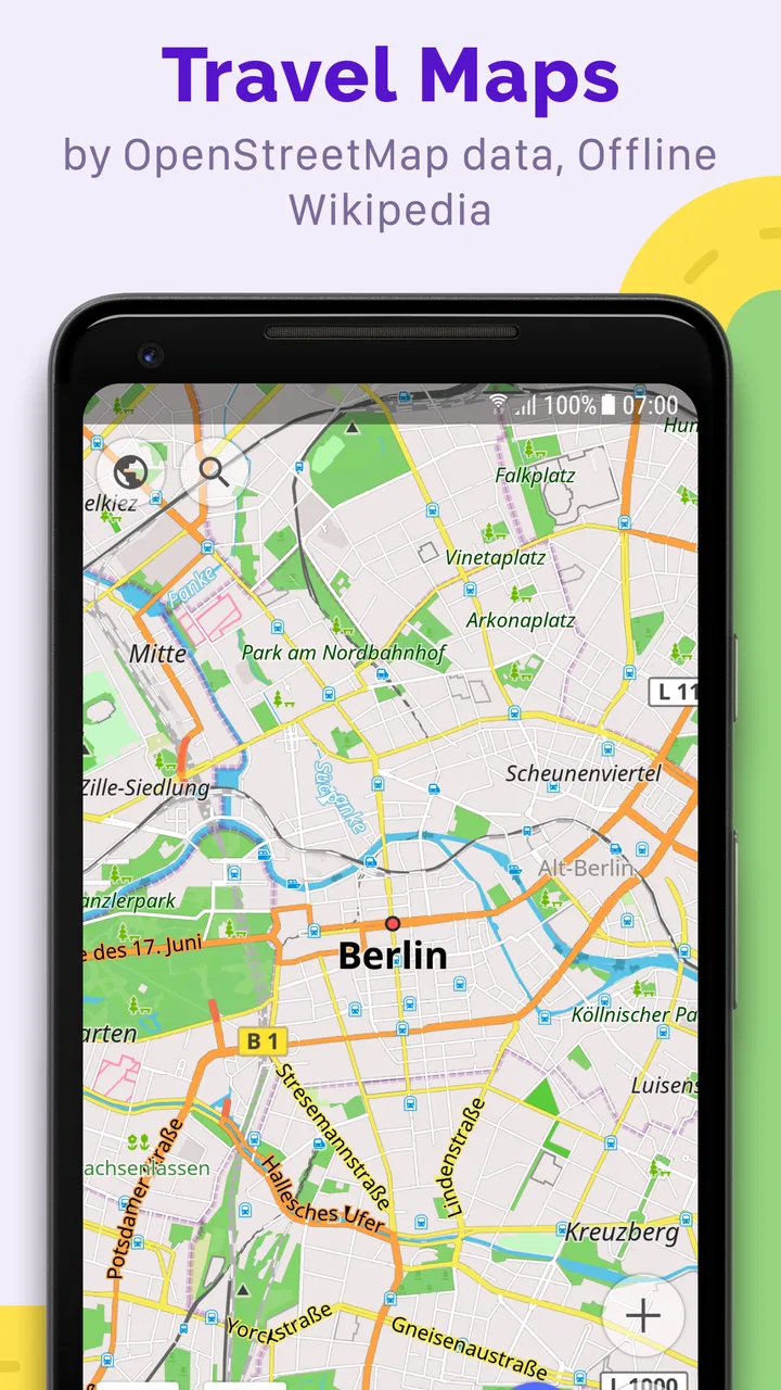
The central capability is offline map use. Instead of waiting for the phone to fetch map information at the moment I need it, I can prepare an area in advance and keep the relevant map available on the device. That changes the experience from “I hope the signal holds” to “I know this area is ready.” For a trail, a long drive through the countryside, or an overseas trip where I want to limit mobile data, that distinction matters.
You May Also Like

 Blood Strike: 2.5 Anniversary
Blood Strike’s Loadouts Turn Every Drop Into a Tactical Gamble
A close look at Blood Strike’s custom loadouts: how fast access to signature weapons reshapes its battle royale rhythm, rewards preparation, and narrows the gap between fights.

 Pandora - Music & Podcasts
Pandora’s Music Is Easy to Start, but Harder to Recover
Pandora’s strength is its low-effort path from a seed to a station. Its weak spot is how much confidence it asks you to place in connection, setup, and quiet recovery.

 8 Ball Pool
 Is Built on Rivalries, Rematches, and Routine
A close look at the rivalries, rematches, shared routines, and unanswered safety questions that turn a quick pool match into a persistent mobile community.

 Samsung Music
’s Quiet Strength Is Playing What You Already Own
Its reach comes less from spectacle than from dependable access to a personal library. That simplicity is both the app’s strongest retention engine and its ceiling.

 AccuWeather: Weather Radar
AccuWeather Review: A Quick, Clear Forecast for Everyday Decisions
For everyday plans, the best forecast is the one you can understand quickly. AccuWeather makes rain timing, radar, and local conditions easy to act on, with a few trade-offs.

 Hill Climb Racing
Why Hill Climb Racing Still Turns Crashes Into One More Run
A tiny car, a bumpy hill and one more upgrade: Hill Climb Racing keeps resurfacing because its simple chaos makes every near-miss feel personal.
More From Our News Desk
View All News


Downloading a map is most useful when it is treated as part of trip preparation rather than an emergency button. I would choose the destination, save enough surrounding area to cover alternate routes, and then check that the map is actually available before leaving. A narrow download around the starting point can become a problem if I take a wrong turn or decide to extend the walk, so I prefer to include nearby roads, trail junctions, and the return route.
The app also lets me put notes on the map. I see this as more valuable than a simple pin dropped at a favorite place. A note can represent a meeting point, a water stop, a parking location, a turn that is easy to miss, or a reminder about where a route changes character. Before a day outdoors, I can mark those details while I still have time to think clearly, then use the map as a personal reference instead of relying on memory.
The important habit is to prepare the map before the journey, not after the signal disappears. Offline navigation is dependable only when the required region has already been downloaded and the phone has enough battery to continue. That sounds obvious, but it is the difference between a calm departure and discovering at the trailhead that the useful part of the map is still online-only.
What the offline workflow feels like
In practice, I would begin by searching for the destination and examining the surrounding map rather than immediately starting navigation. This lets me see whether the route passes through several areas and whether I need a wider download. I would then save the map for offline use, add personal notes, and open the saved area once more before leaving. That final check is a small step, but it prevents the common mistake of assuming that a visible map was stored locally.
Once I am away from coverage, the advantage is straightforward: the map remains useful for orientation and route decisions without depending on a continuous data connection. I can look at the broader area, compare nearby roads or paths, and return to a marked point. The experience feels more like carrying a prepared paper map with a searchable interface than using a conventional live-navigation service.
That comparison also explains the learning curve. A typical phone map is designed to get me from one address to another with minimal setup. OsmAnd asks me to make more decisions. I need to think about the area I am saving, the information I want to mark, and how much detail is useful for the trip. I appreciate that control, but someone who only wants an instant route to a restaurant may find it unnecessarily involved.
For driving, I would still prepare the offline area before starting the engine and avoid making map changes while moving. For walking, I would zoom out before departing so I understand the surrounding landscape and possible alternatives. The app becomes more useful when I treat navigation as an activity to prepare, not just a voice instruction to follow.
A realistic day on the trail
Imagine I am visiting a rural area for a day hike. At home, I download the map covering the trailhead, the route, and the nearby roads. I add a note at the parking area, another at a junction where the path branches, and one at a point where I plan to stop for lunch. I also save the location of the accommodation or transport pickup point so the return journey is easy to find.
At the trailhead, I check the downloaded area and make sure the phone is not relying on a live connection. During the hike, I can refer to the map when the path becomes confusing, see how far I have moved from the planned route, and use the notes as reminders. If the weather changes or I feel tired, I can make a more informed decision about turning back because I can view the surrounding area rather than only the next instruction.
The notes are especially useful for group trips. If friends are arriving separately, I can mark the exact meeting place and share the description verbally without trying to explain a vague landmark. On a return visit, those same notes can make the map feel familiar even when the landscape looks different because of weather, light, or seasonal changes.
There is a practical limitation: an offline map is not a substitute for judgment. I would not assume that every path shown is comfortable, open, or appropriate for current conditions. The app can help me understand location and direction, but I still need to check the route beforehand and carry sensible backup information for a serious outing. Its strength is reducing dependence on connectivity, not removing the need for preparation.
Where it is stronger than ordinary map apps
The usual alternative is a mainstream map app that excels at live traffic, business searches, and quick car directions. That is often the better choice for a city errand. If I am leaving work and need the fastest route to a shop, I value current traffic and a frictionless search more than detailed offline planning. OsmAnd’s approach is more deliberate and therefore less convenient for that narrow task.
Where it pulls ahead is in the gap between connected navigation and a traditional map. I can prepare a region, keep it available, and add my own reference points. This is useful for travelers who move between cities, walkers who leave built-up areas, and drivers crossing places where coverage may be inconsistent. The app’s purpose becomes clearer when the destination is not just an address but an area I need to understand.
Compared with a paper map, the benefit is searchability and personal annotation. I can look for a place by name, move between broad context and local detail, and keep notes attached to the map. Paper still has advantages for battery-free backup and group viewing, so I would not discard it for demanding trips. My preferred setup is to use the app for planning and orientation while keeping a simple backup when the outing is important.
Compared with a lightweight hiking app, OsmAnd can feel more like a general navigation tool than a single-purpose trail companion. That flexibility is valuable if a trip combines walking, driving, and public-road navigation. The trade-off is that I have more settings and map decisions to understand. It rewards curiosity, while a simpler tool may be friendlier for someone who wants only a clean trail view.
The friction I noticed before trusting it
The first source of friction is storage planning. Offline maps are useful precisely because they live on the phone, so I need to be selective about the regions I keep. Saving a small area may leave gaps around the route; saving everything without thinking can make the device harder to manage. I prefer downloading only the places connected to the current trip and removing old areas afterward.
The second is the difference between seeing information and understanding it. A detailed map can show many roads, paths, and points of interest, but that does not automatically tell me which option is best for my ability, vehicle, or current conditions. I need to inspect the route before departure and avoid treating every line as a promise. This is a general navigation lesson, but the app’s rich map view makes it especially important.
The third is the setup burden. Notes, saved areas, and route choices are valuable only if I use them consistently. A person who refuses to spend a few minutes preparing may conclude that the app is cumbersome. I think that criticism is fair. Its offline strength is earned through planning, whereas many familiar map apps feel useful immediately after installation.
Battery management also matters on long outings. Keeping a screen active and using location services can reduce battery life, even when the map itself is offline. I would lower screen brightness, avoid unnecessary screen checks, and carry a power bank for a full-day trip. The app reduces the need for network access, but it does not make the phone independent of power.
Who gets the most from this app
I would recommend it most strongly to hikers, road-trippers, travelers exploring areas with uncertain coverage, and people who like to plan routes in detail. It is also a good fit for anyone who wants personal notes attached to places rather than relying on a separate notebook or memory. The free starting price makes it easy to test the workflow before deciding whether additional in-app options are worthwhile; available purchases range from about $1.63 to $69.99 per item.
It is less convincing for someone whose navigation is almost entirely urban and connected. If every trip is a short drive to a known business, a simpler map service may open faster and provide more relevant live information. I would also hesitate to recommend it to a user who dislikes exploring settings or preparing maps in advance. The app is not difficult because the basic idea is obscure; it is demanding because it gives me more responsibility.
The everyone content rating makes it suitable for a broad audience, but suitability still depends on the trip. A child using it with an adult may find the map interesting, while a solo traveler should understand the limits of digital navigation before depending on it in a remote area. I see it as a planning and orientation tool, not a replacement for common sense, local awareness, or appropriate equipment.
Small habits that make the offline feature better
My first tip is to download beyond the exact route. Include the approach road, likely detours, and the destination area. This is particularly important when a hike begins in one map region and finishes near another, or when a road trip includes an unplanned overnight stop. The extra context is usually more valuable than saving a perfectly narrow corridor.
My second tip is to use notes before they become necessary. Mark the car, accommodation, meeting point, and any turn that you already know could cause confusion. During a stressful moment, a personal note is faster to interpret than trying to reconstruct a plan from a general map. I would keep the wording short and practical so the note remains useful at a glance.
My third tip is to test the complete workflow at home. I would switch off connectivity, open the saved area, search within it, and confirm that my important notes are visible. This rehearsal answers the question many new users have: “Will it work when I am offline?” The answer depends less on hope than on whether I have actually checked the exact region and route I intend to use.
My fourth tip is to separate planning from navigation. I prefer to inspect the route while relaxed, then use the phone mainly for confirmation once I am moving. This reduces screen time, saves battery, and helps me notice when the real surroundings do not match my expectations. The map should support attention to the environment, not replace it.
My recommendation after using it
OsmAnd earns its place by solving a specific travel problem well: it lets me prepare a map and carry that preparation into places where a live connection cannot be taken for granted. The downloadable map is not a decorative extra; it changes how confidently I can approach a hike, rural drive, or unfamiliar trip. Personal notes make the feature more practical because they turn a general map into something tailored to my plans.
I would choose it over a standard online map when offline access and wider-area planning matter more than instant simplicity. I would choose a mainstream alternative for traffic-heavy city driving or quick business searches. That is not a weakness so much as a clear boundary. This app is at its best when I have somewhere to explore and a reason to prepare.
With its free entry point, mature history, broad adoption, and current version 5.2.13, it is easy to try without committing to a complicated travel setup immediately. My advice is to start with one realistic trip, download the area early, add a few meaningful notes, and test it without a connection. If that preparation feels worthwhile, the app can become a dependable part of your travel routine. If you want navigation to do all the thinking for you, its level of control may feel like work rather than freedom.
FAQs for OsmAnd — Maps & GPS Offline
01What features does OsmAnd offer for offline navigation?
OsmAnd provides comprehensive offline navigation features, including customizable maps, voice guidance, and the ability to search for addresses and points of interest without an internet connection. Users can download specific regions or countries for offline use, ensuring they have access to detailed maps and navigation tools even in areas without network coverage.
02How accurate are the maps in OsmAnd?
OsmAnd uses data from OpenStreetMap, a collaborative mapping project that is updated frequently by contributors worldwide. This ensures high accuracy and up-to-date information. However, as with any map service, occasional discrepancies may occur, and users are encouraged to contribute corrections to improve the maps further.
03Does OsmAnd support different types of map views?
Yes, OsmAnd supports various map views to cater to different needs. Users can switch between standard, topographic, and cycling maps. The app also offers options to display contour lines, hillshades, and various overlays such as public transport routes, enhancing the map's utility for diverse activities.
04Is OsmAnd suitable for outdoor activities like hiking or cycling?
Absolutely, OsmAnd is ideal for outdoor enthusiasts. It offers features like GPX track recording, detailed topographic maps, and offline route planning. Cyclists and hikers can benefit from the app's ability to display elevation data and specific trail information, making it a reliable companion for outdoor adventures.
05How does OsmAnd handle map updates?
OsmAnd allows users to download map updates regularly. These updates are crucial for maintaining accuracy and adding new features or roads. Users can choose to update maps manually or set them to update automatically when connected to Wi-Fi, ensuring the latest data is always available without consuming mobile data unnecessarily.
Pros
- Highly detailed offline maps available.
- Customizable map layers and features.
- Regular updates with new data.
- Supports various map formats.
- Open-source and privacy-focused.
Cons
- Can be resource-heavy on older devices.
- Complex interface for new users.
- Some features require paid plugins.
- Occasional map rendering delays.
- Limited real-time traffic updates.

OsmAnd — Maps & GPS Offline
Gallery